HOME | DOWNTOWN | HOUSES AND APARTMENTS | COMMERCIAL BLDGS. | MISCELLANEOUS LOCATIONS | LINKS | NEXT PHOTO
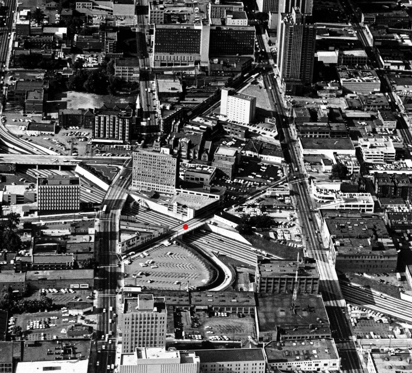
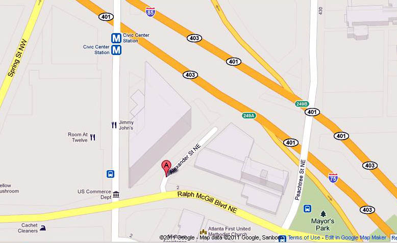
Here's a pretty spectacular 1965 aerial photo that looks to the south from the north side of downtown. It comes to us from the Atlanta History Center's superb photo archives and perhaps the most interesting aspect of the photo from my perspective is the presence of a bridge over I-78/85 that no longer exists. I put a red dot on the bridge so you can easily locate it. Looks to me (from the Google Maps image below) that this was Alexander Street and when this photo was taken it connected Peachtree Street to West Peachtree Street, though the map makes it look like Alexander Street's course was eventually changed slightly so that it connected with Ralph McGill Boulevard instead of West Peachtree.
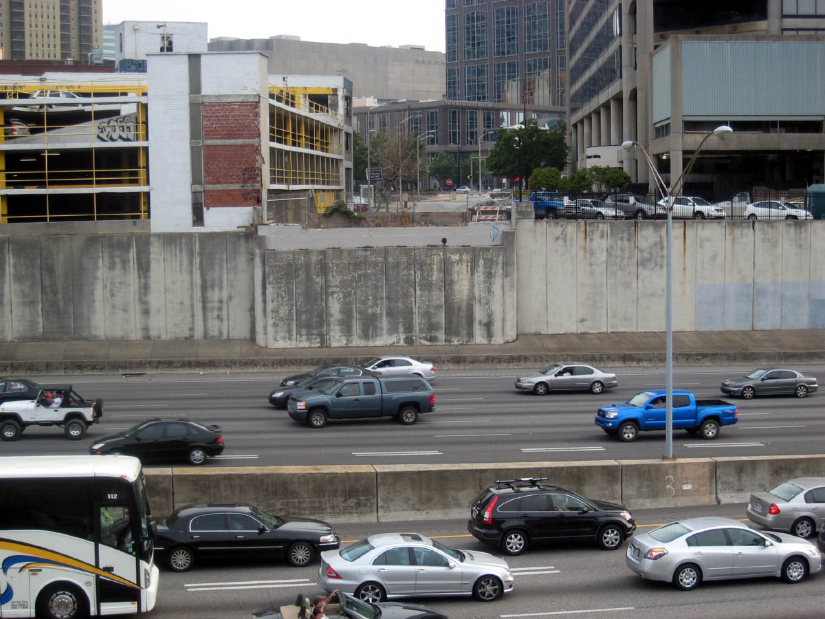
So when did this bridge come down and why? I have a 1968 Atlanta map that I consulted and it looks like it was gone by then. Also below is a June 2011 photo looking southwest across the interstate to the site of the former bridge and you can see the outline of where the bridge used to be.
Thumbnails of many more aerial view photos can be found here.
HOME | DOWNTOWN | HOUSES AND APARTMENTS | COMMERCIAL BLDGS. | MISCELLANEOUS LOCATIONS | LINKS | NEXT PHOTO