HOME | DOWNTOWN | HOUSES AND APARTMENTS | COMMERCIAL BLDGS. | MISCELLANEOUS LOCATIONS | LINKS | NEXT PHOTO
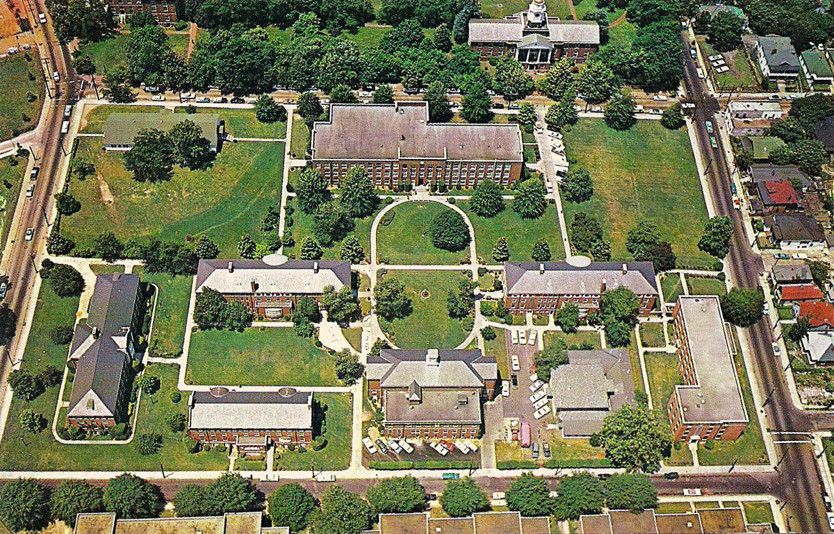
This undated postcard, from the 1960s I'd guess, shows an aerial view of a portion of the Atlanta University complex, the group of historic black colleges in Atlanta that was founded with Atlanta University in 1865. Later, Morehouse College (1867), Clark College (1869), and Spelman College (1881) joined the consortium, formally known as the Atlanta University Center. In 1988, Clark College and Atlanta University merged to form what is now known as Clark Atlanta University.
This view looks to the west, showing Haven-Warren Hall at the top/center of the photo. Behind it is James P. Brawley Drive, formerly known as Chestnut Street. On the right side of the photo is the former Fair Street. In late 2010, the 14 block section of Fair Street between Northside Drive and Joseph E. Lowery Boulevard (formerly Ashby Street) was renamed Atlanta Student Movement Boulevard. Lawshe Street runs along the bottom edge of the photo, and Greensferry Avenue is the street on the left. Google map
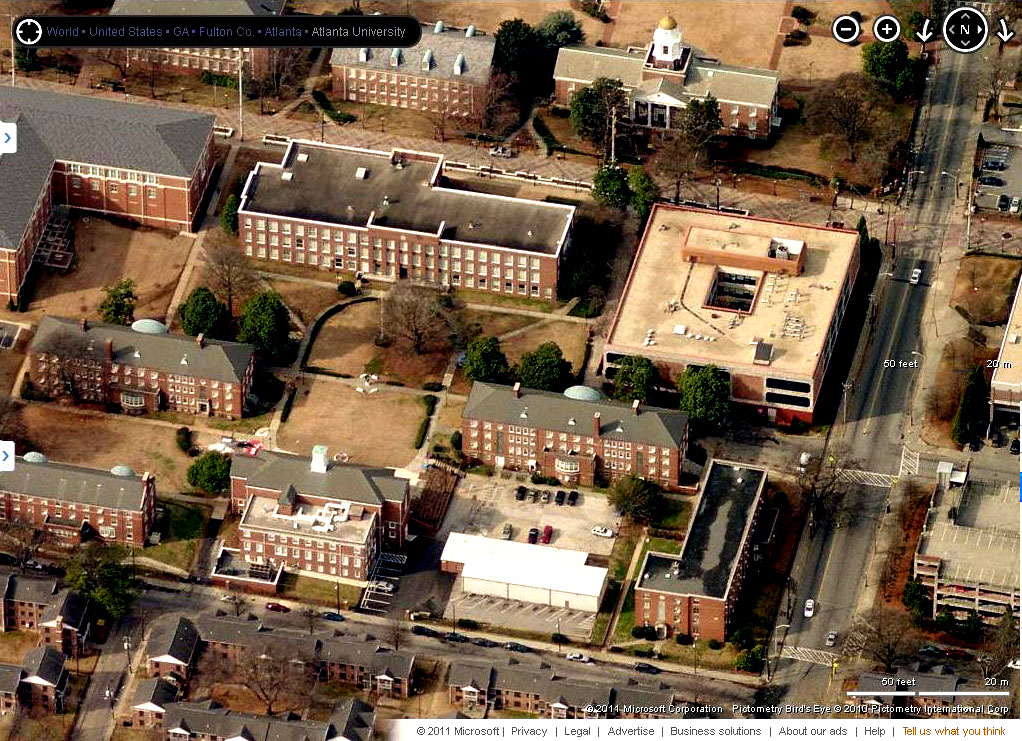
The more or less contemporary photo above showing the greater density on the campus was harvested from Bing Maps, using their Bird's Eye option.
HOME | DOWNTOWN | HOUSES AND APARTMENTS | COMMERCIAL BLDGS. | MISCELLANEOUS LOCATIONS | LINKS | NEXT PHOTO