HOME | DOWNTOWN | HOUSES AND APARTMENTS | COMMERCIAL BLDGS. | MISCELLANEOUS LOCATIONS | LINKS | NEXT PHOTO
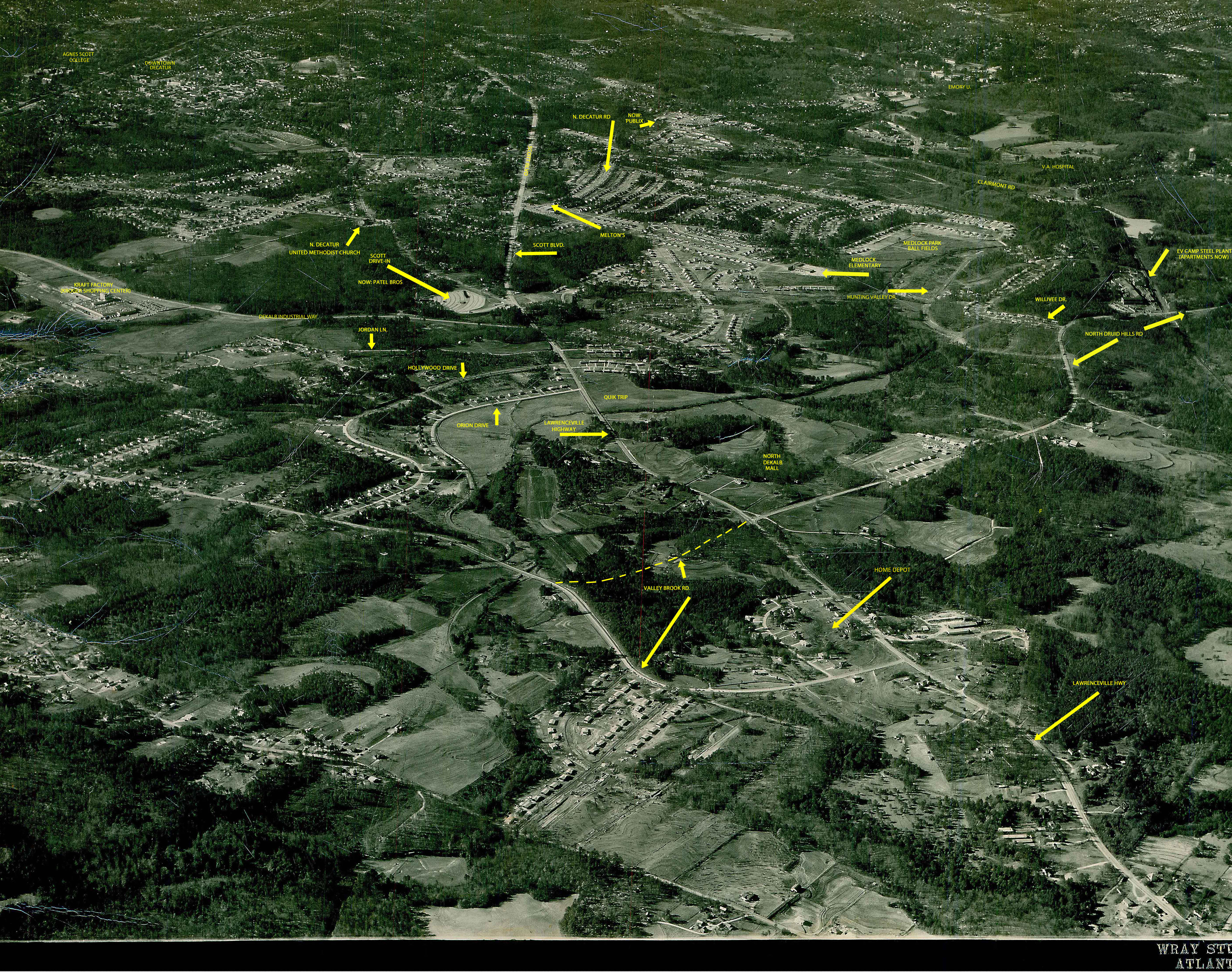
This is the second of two circa 1955 aerial photos showing the north side of downtown Decatur and the surrounding areas, including Medlock Park. (The first one is here). I added some identifying graphics to this one to help viewers get their bearings. You might find it helpful to manipulate the size of the photo by holding down the "control" button and using the roll bar on your mouse if you have one to zoom out and back in again, which is very helpful in gaining perspective.
One thing that really caught my eye is the fact that North Druid Hills Road used to end where it intersects with Lawrenceville Highway. Now the road continues on as Valley Brook Road, which I marked with a dotted yellow line. In the photo below, we see that Valley Brook Road continued on in a northerly direction before intersecting with Lawrenceville Highway near the present location of Home Depot. And sure enough, consulting Google Maps shows that there is a North Valley Brook Rd. in precisely that spot today. More aerials of this vicinity can be accessed here.